
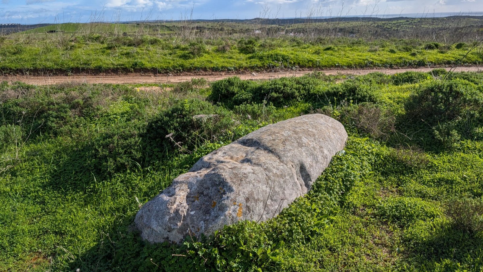
Broken stones lie scattered in the fields above Sagres and the Cabo de São Vicente. If you look closely at them, you’ll see that they are shaped into smooth obelisks. Were these territorial markers in ancient times? Did prehistoric people use them for ritual purposes? We don’t really know. Today, they are merely stones lying in a field.
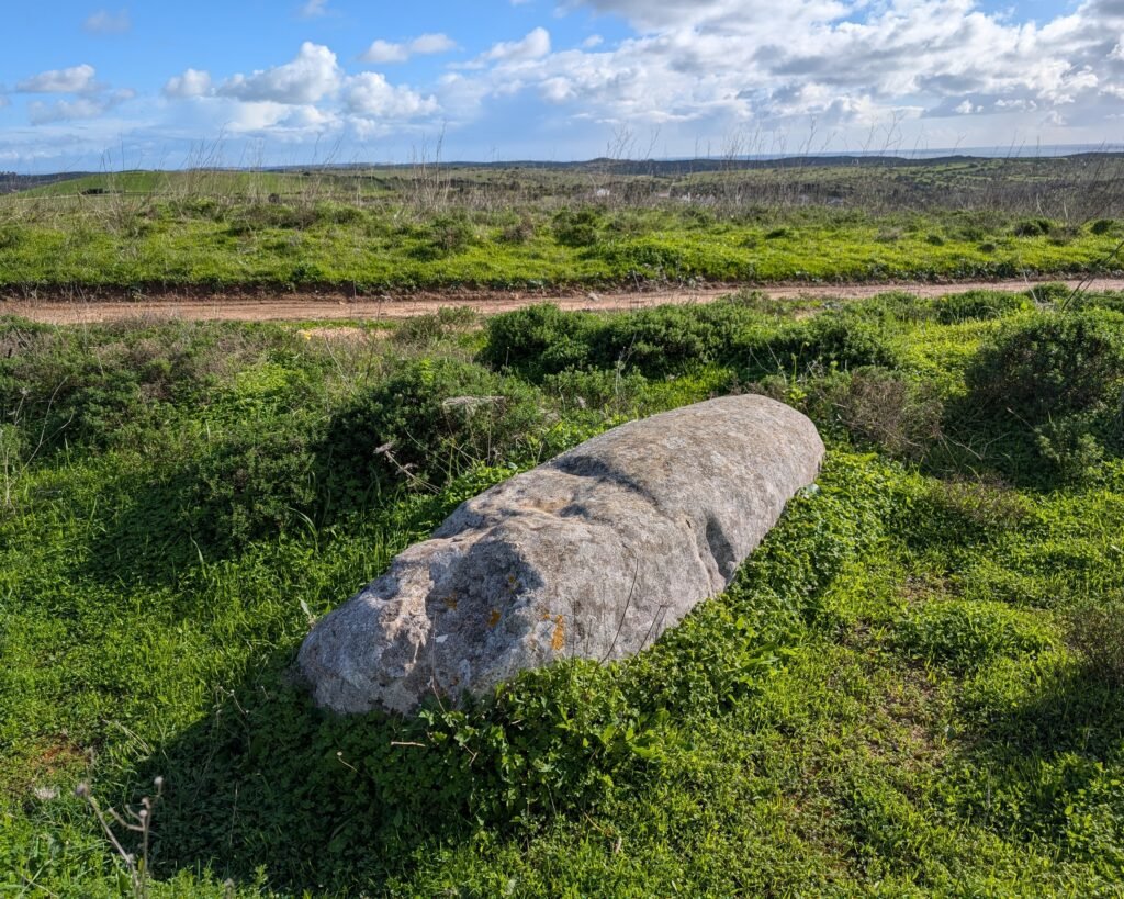
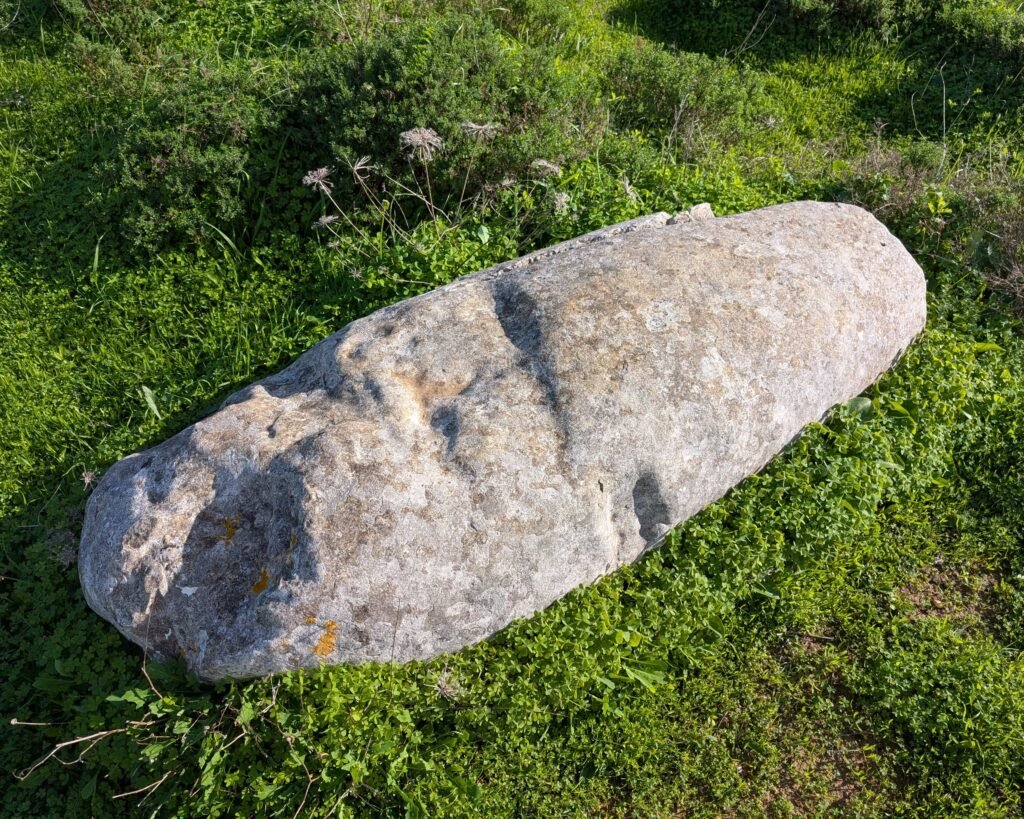
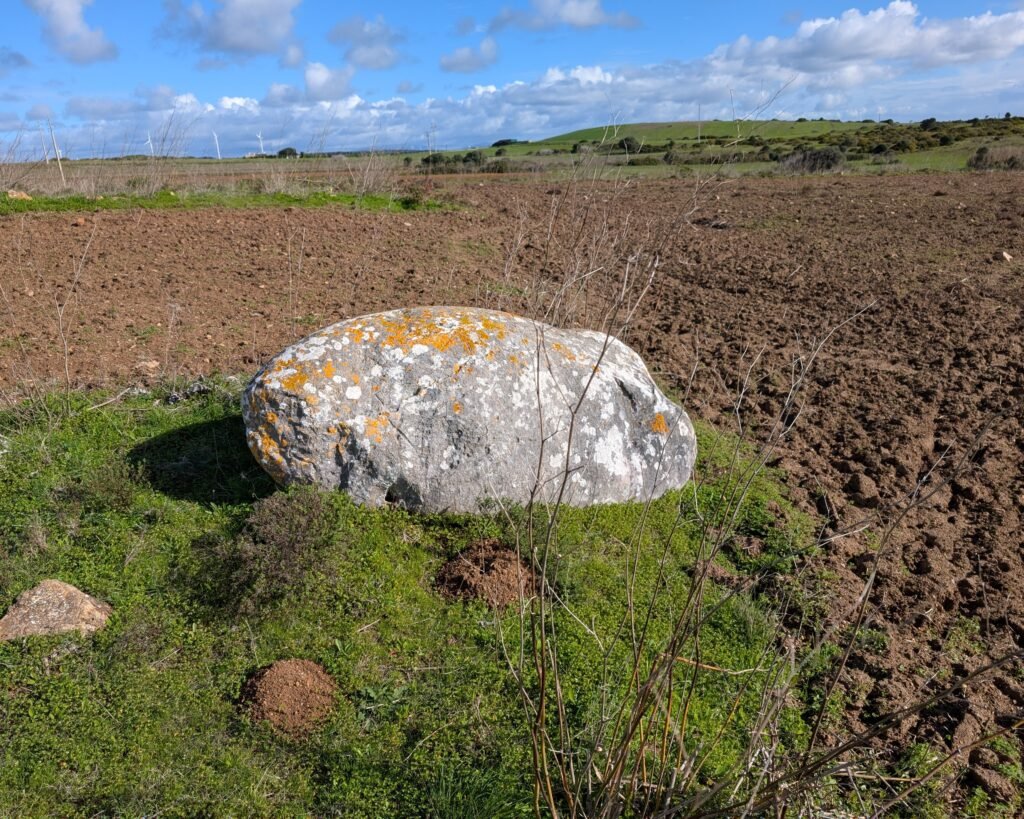
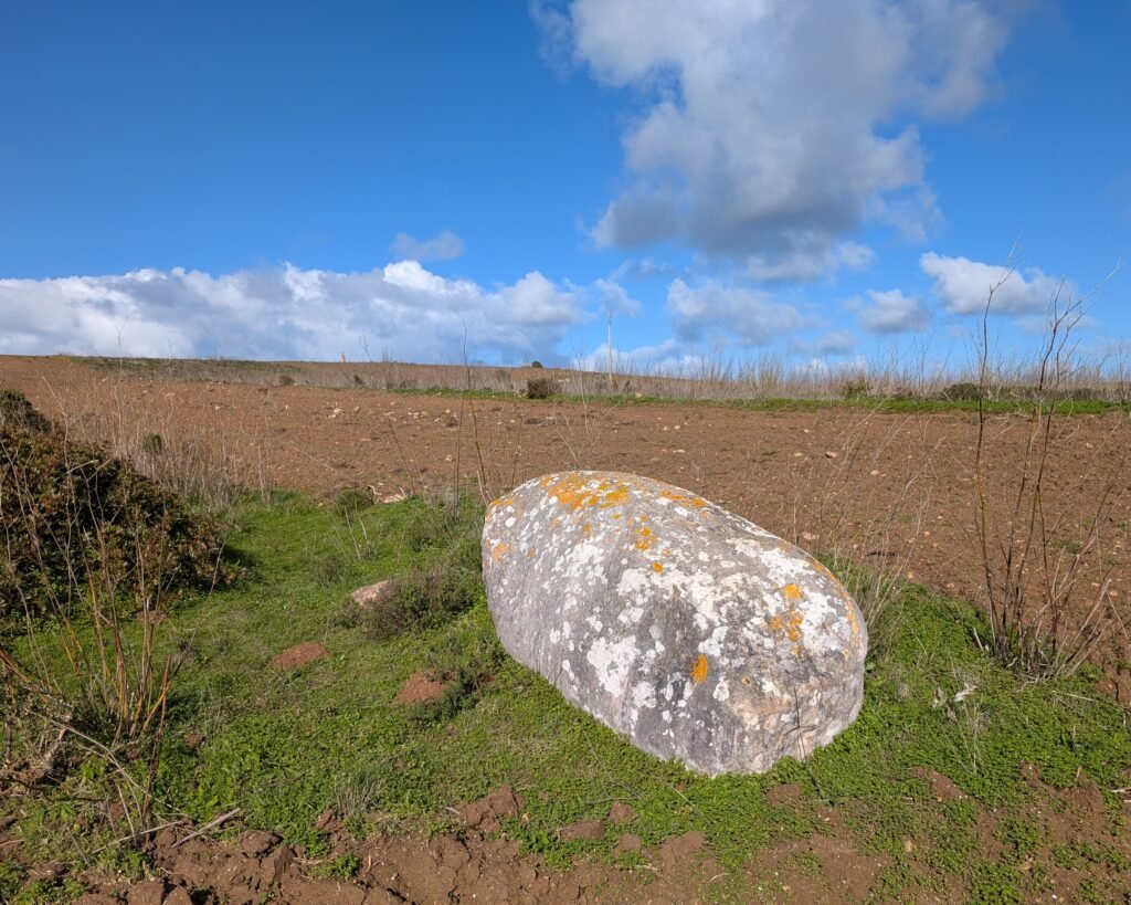
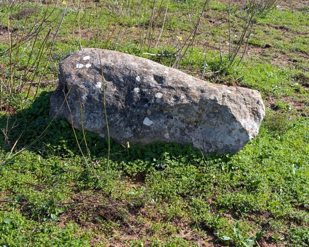
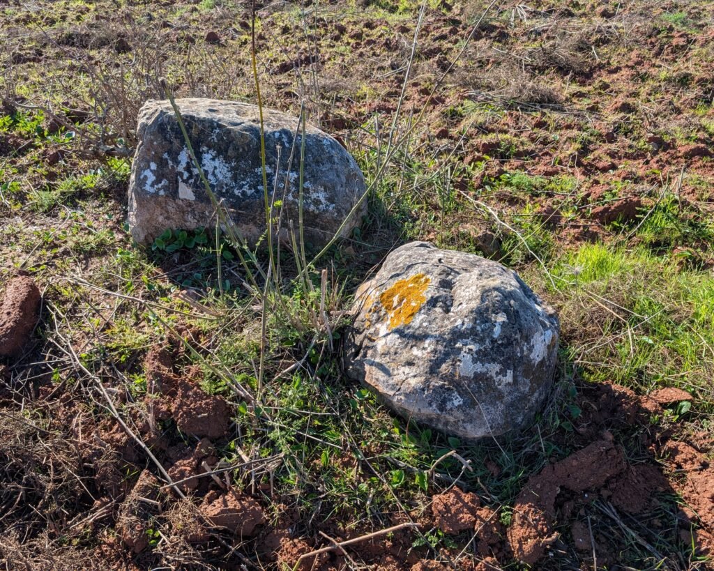
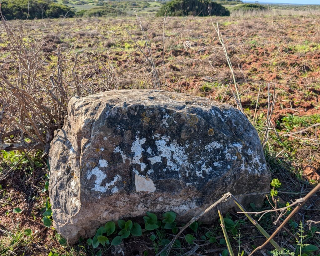
There are more than twenty menires (“menhirs”) in the area, all fallen. Some are broken. They have very likely been moved from their original locations by farmers. (This area was heavily used for wheat farming in the 20th century.) They are not well documented or listed.
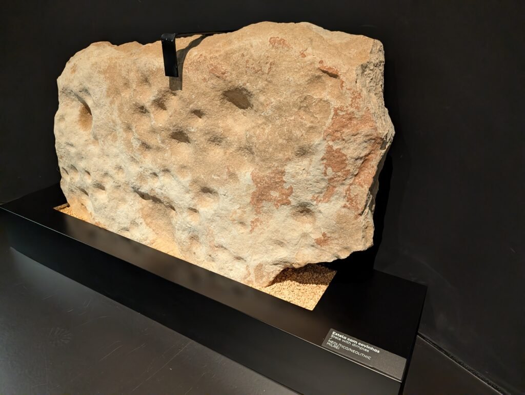
They are carved from limestone: generally smooth, cylindrical or conical in shape. They are all white or yellowish in colour, ranging from just under a meter to about 2m in height. They date back to the Neolithic or Chalcolithic period (5500-2000BC), based on their constructions and decorations (some have cup marks or wavy lines).1
There are other menires in the area, including the very near Padrão group (possibly a cromeleque) and the slightly further menir of Aspradantes. This group of menires was identified by E. Prescott Vicente and A. Da Silveira Martins in 1979, subsequently the surrounding area was surveyed and the data published by Mário Varela Gomes in the 1980s.2
The menires are not definitively numbered. I have numbered them on this website based on their distance from the Milrei marker. I was able to visit and document four menires. There is a fifth according to the Via Algarviana hiking map, but I was turned away by dogs.
Location
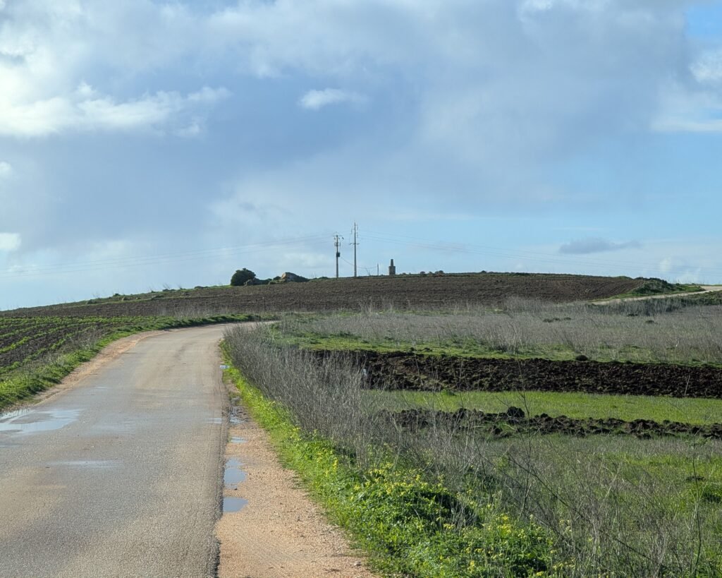
In Portugal’s Algarve, district of Faro. The menires are in the municipality of Vila do Bispo, near the town of Raposeira. They are in various locations around the geodesic marker of Milrei (a cement marker on top of the hill).
Access
There are trails and dirt roads that take you near several of the menires. You may have to walk through a field to get to a few of them.
Signage
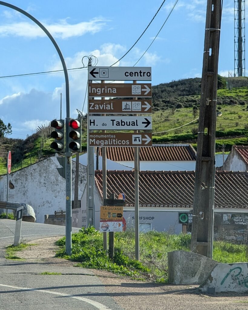
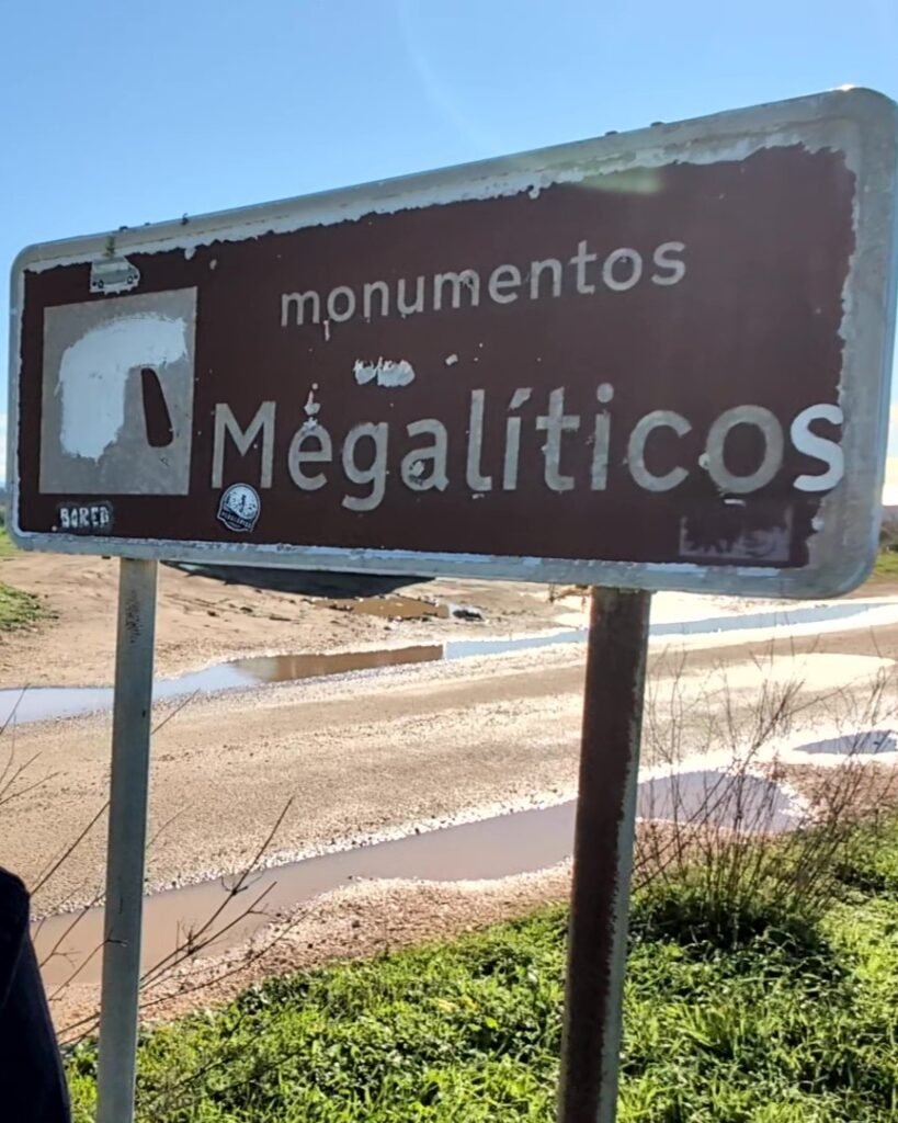
There are signs in Raposeira (the town just west of Vila do Bispo, on the road to Lagos) directing you to the “Monumentos Megalíticos.” There is another “Monumentos Megalíticos” sign on the road near the geodesic marker of Milrei. The stones themselves are not signposted.
Links
- Article (in Portuguese) from Wikipedia
- Entries (in English) in the Megalithic Portal
- Blog post (in Portuguese) by archaeologist Ricardo Soares
- Walking trail with PDF map (in English) from the Via Algarviana
- Description (in Portuguese) from Archaeologist’s Portal of Directorate-General of Cultural Heritage
- Entry (in Portuguese) in the database of the Directorate-General of Cultural Heritage
Nearby
The Menir do Padrão is the only erected menhir of the hundreds in the area of Vila do Bispo and is just a short walk (about 800m) down the road from the Milrei marker. There are more menhirs of Padrão near it, possibly forming a cromlech. The Menir de Aspradantes is in the vicinity. You can get much more information about the prehistory of the area in the museum in Vila do Bispo.
Sources
- GOMES, Mário Varela, SILVA, Carlos Tavares da e MARTINS, Isilda Maria Pires (1987). Levantamento arqueológico do Algarve: concelho de Vila do Bispo. Lisboa: Delegaçao Regional do Sul. S.E.C. https://www.academia.edu/124029507/Levantamento_arqueol%C3%B3gico_Vila_do_Bispo Accessed 15 January 2026. ↩︎
- Gomes, Mário Varela. “Megalitismo Do Barlavento Algarvio – Breve Síntese.” Setúbal Arqueológica, vol. 11-12, 1997, pp. 147–190, maeds.amrs.pt/publicacoes/setubal-arqueologica#faq-9. Accessed 14 Jan. 2026. ↩︎
Pingback:Menires do Padrão - Prehistoric Portugal
Pingback:Menir do Padrão - Prehistoric Portugal