
Two groups: Cromeleque de Amantes 1, Cromeleque de Amantes 2 (also known as Menires de Amantes 2)
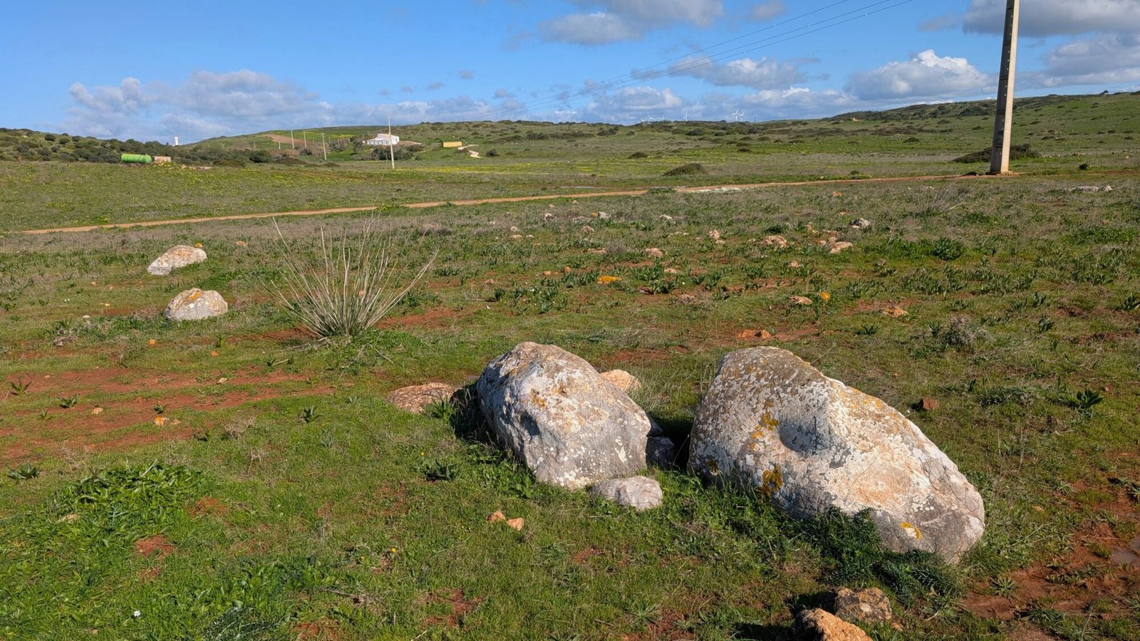
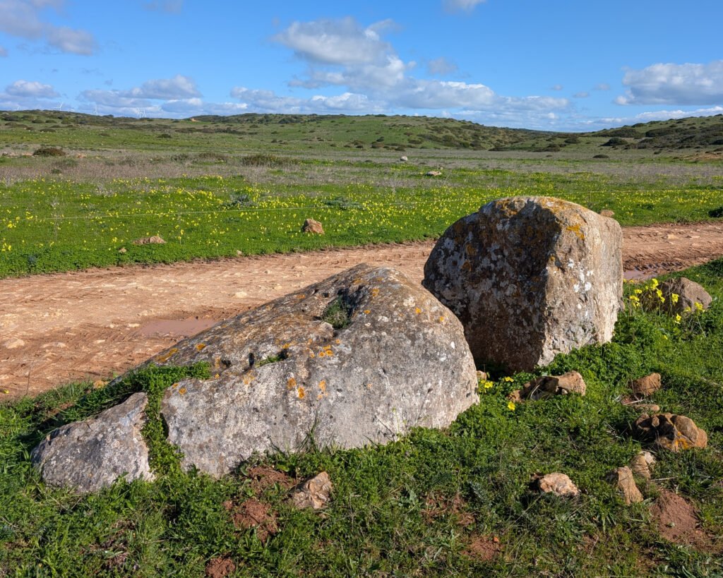
Walking around the field, several large stones stand out. They’re toppled over and broken, but their smoothed cylindrical shape belies their origins: these are shaped stones, made into menires (Portuguese spelling), or standing stones, thousands of years ago.
These aren’t just any menires: they are part of a stone circle, or cromeleque (Portuguese spelling). The Cromeleque de Amantes 1 was identified in the 1970s by archaeologist Mário Varela Gomes and documented in the 1980s1. Contemporary maps and guides to the megaliths of the area of Vila do Bispo don’t mention it. Gomes identified the nearby group of menires as being “Menires de Amantes 2,” stating it was possibly a cromeleque. The Archaeologist’s Portal on the Cultural Heritage website identifies it as a second cromeleque.
Amantes 1
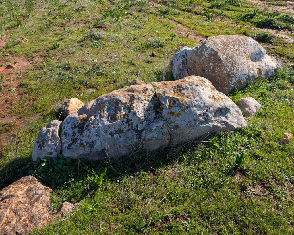
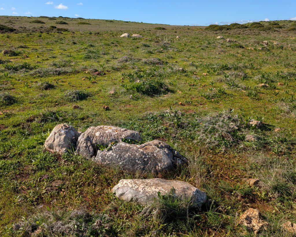
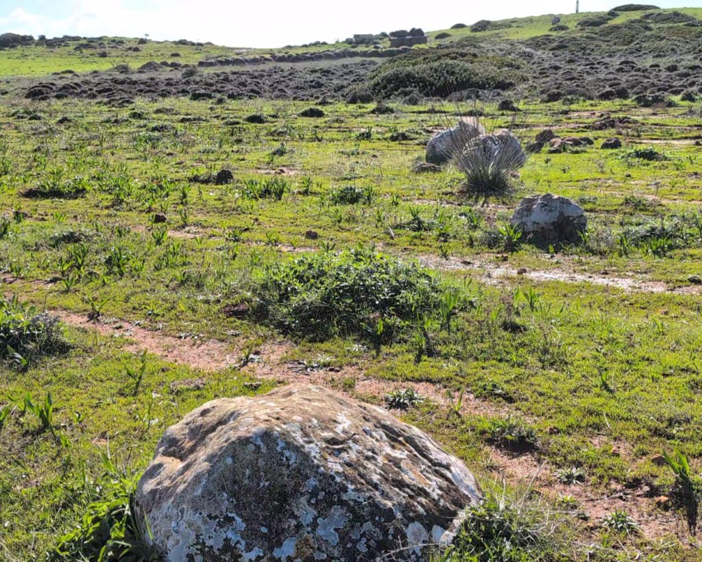
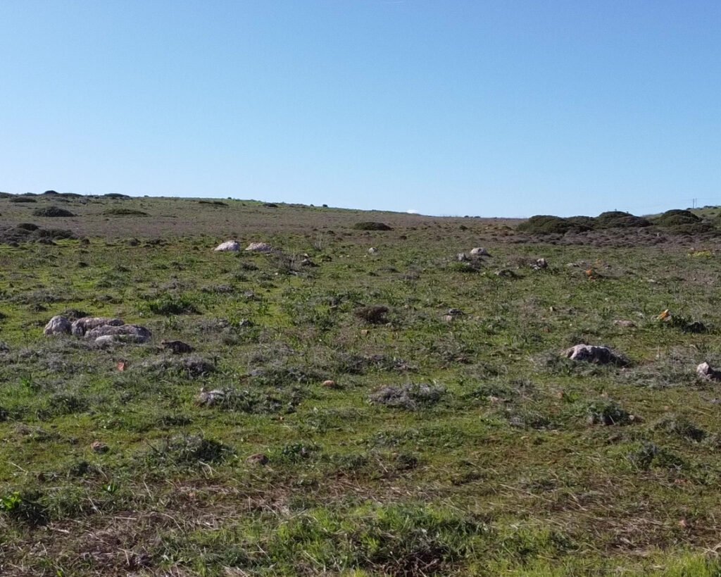
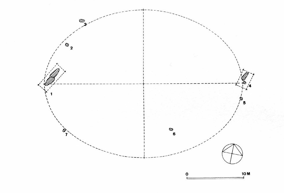
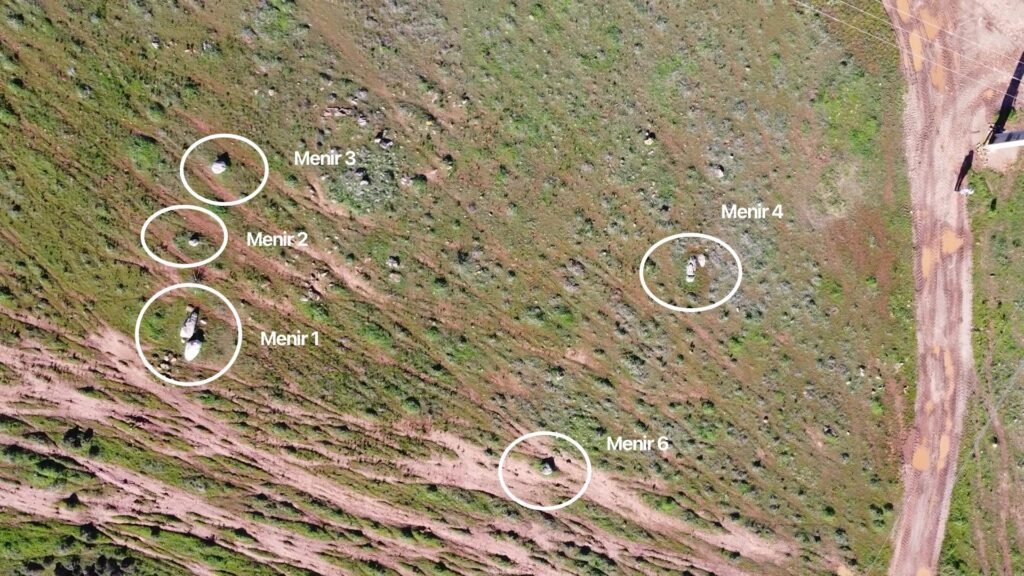
This cromeleque is in elliptical shape, with its long axis oriented east-west and measuring around 35 meters. There were originally seven menires documented, all cylindrical and made from white limestone. They measured from a little over a half meter to nearly 4 meters in height. I was able to identify five of them. There were two other stones that may have been the others, moved out of their original locations.
The following comparison of old and new photographs verifies that this is Gomes’ Cromeleque de Amantes 1.

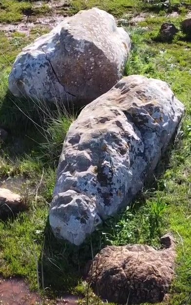
Artefacts found during excavation included various stone tools. These allowed the cromeleque to be dated to the Late Neolithic (about 3500 – 2800 BC), but it’s possible it was constructed earlier than that. The fallen menir 1 was seen to have been used as a grinding stone, shown by the groove in its side.
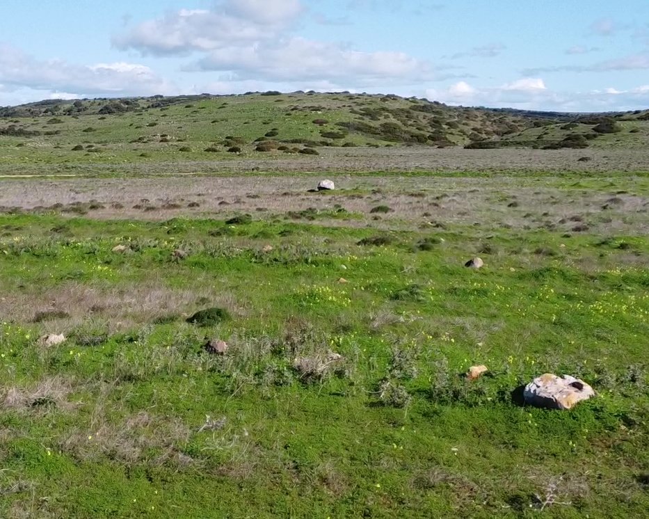
Amantes 2
This group of menires is very close to Amantes 1, about 100m to the East. It was likely another cromeleque, again elliptical but oriented northeast to southwest. The minor axis would have been about 40m long. There were ten menires found, ranging from a half meter to 3 meters in length.
I was able to photograph one of the menires, but the rest are behind property fences.
Location
The cromeleques are in Portugal’s Algarve region, district of Faro, municipality of Vila do Bispo. They are in a field outside of Vila do Bispo, near the Monte dos Amantes hill. Coordinates for Amantes 1’s menir 1 (the largest) are 37.064944, -8.916051 while the coordinates for the large menir for Amantes 2 are 37.064850, -8.914970
Access
Head south out of Vila do Bispo past the Lidl supermarket. A little more than 1km out of town, there’s a left turn through a tunnel under the main road heading to Sagres. (The sign is below.) Go through that and there’s a parking area next to a small wooded park with a swing. You can easily reach the cromlech along that road: it’s about 500m after the tarmac ends.
Signage
At the turn where the road goes under the main Bispo-Sagres road, there is a sign pointing out the “Roteiro Megalítico” (Megalithic Route) and “Percurso Pedestre” (Pedestrian Trail) for Monte dos Amantes. There are no signs for the cromlech.

Links
- Articles (in Portuguese) from Wikipedia
- Entries (in English) in the Megalithic Portal
- Map, “À Descoberta dos Menires – Roteiro do Monte dos Amantes” (in Portuguese) by João Velhinho, published by Town Hall of Vila do Bispo
- Descriptions (in Portuguese) from Archaeologist’s Portal of Directorate-General of Cultural Heritage
- Designation (in Portuguese), as part of the “Conjunto de Menires de Vila do Bispo,” being “in the process” of designation as a Property of Public Interest by the Directorate-General of Cultural Heritage
- Entry (in Portuguese), as part of the “Conjunto de Menires de Vila do Bispo,” in the database of the Directorate-General of Cultural Heritage
Nearby
The Menires of Pedra Escorregadia (and the necropole next to them) are on the same road/route. There are other menires in the area, although they are not well marked or easily identified. The museum in Vila do Bispo (“Celeiro da História”) is an excellent source of information, including maps of the route.
Sources
- GOMES, Mário Varela, SILVA, Carlos Tavares da e MARTINS, Isilda Maria Pires (1987). Levantamento arqueológico do Algarve: concelho de Vila do Bispo. Lisboa: Delegaçao Regional do Sul. S.E.C. https://www.academia.edu/124029507/Levantamento_arqueol%C3%B3gico_Vila_do_Bispo Accessed 15 January 2026. ↩︎
- Gomes, “Levantamento…” (1987) page 50 ↩︎
- Gomes, Mário Varela. “Megalitismo Do Barlavento Algarvio – Breve Síntese.” Setúbal Arqueológica, vol. 11-12, 1997, pp. 147–190, maeds.amrs.pt/publicacoes/setubal-arqueologica#faq-9. Accessed 14 Jan. 2026. ↩︎
Pingback:Pedra Escorregadia - Prehistoric Portugal