
Also known as: Anta da Casa dos Mouros
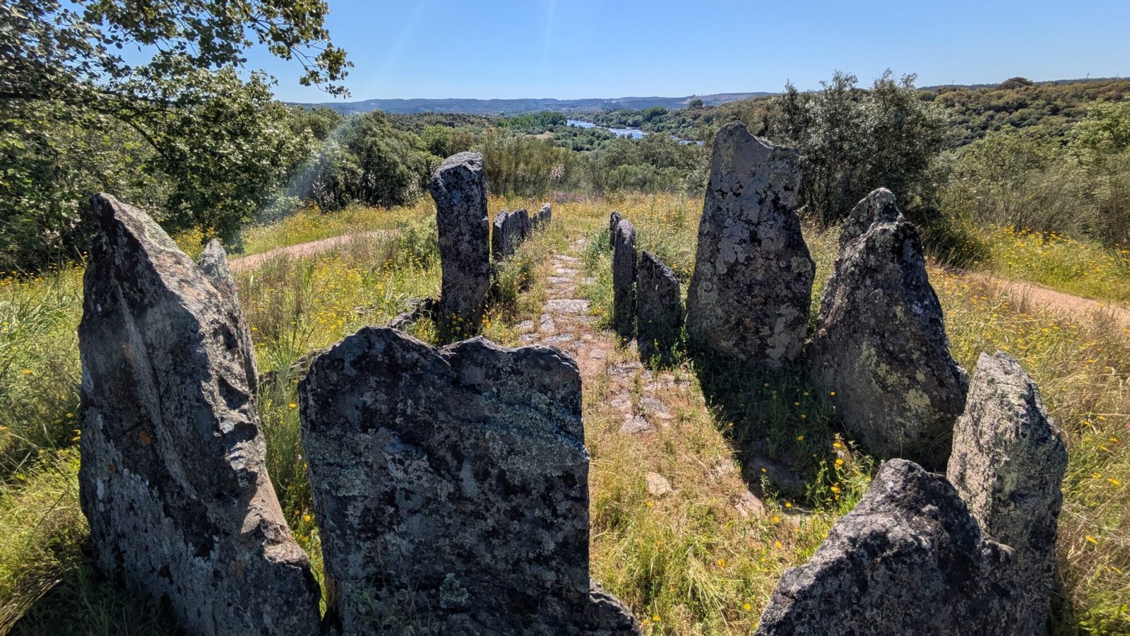
In the sunshine, the light glints off the river below. Birds and insects fill the air with sound, competing with the hum of traffic on the bridge across the river. A riot of wildflowers splashes the green vegetation with yellows, pinks, and more. It’s a gorgeous and quiet spot, and the stones surrounding you frame the view beautifully. They have stood here for over six thousand years, and they’ll still be here long after you depart. Their permanence adds to the peacefulness of this wild spot.
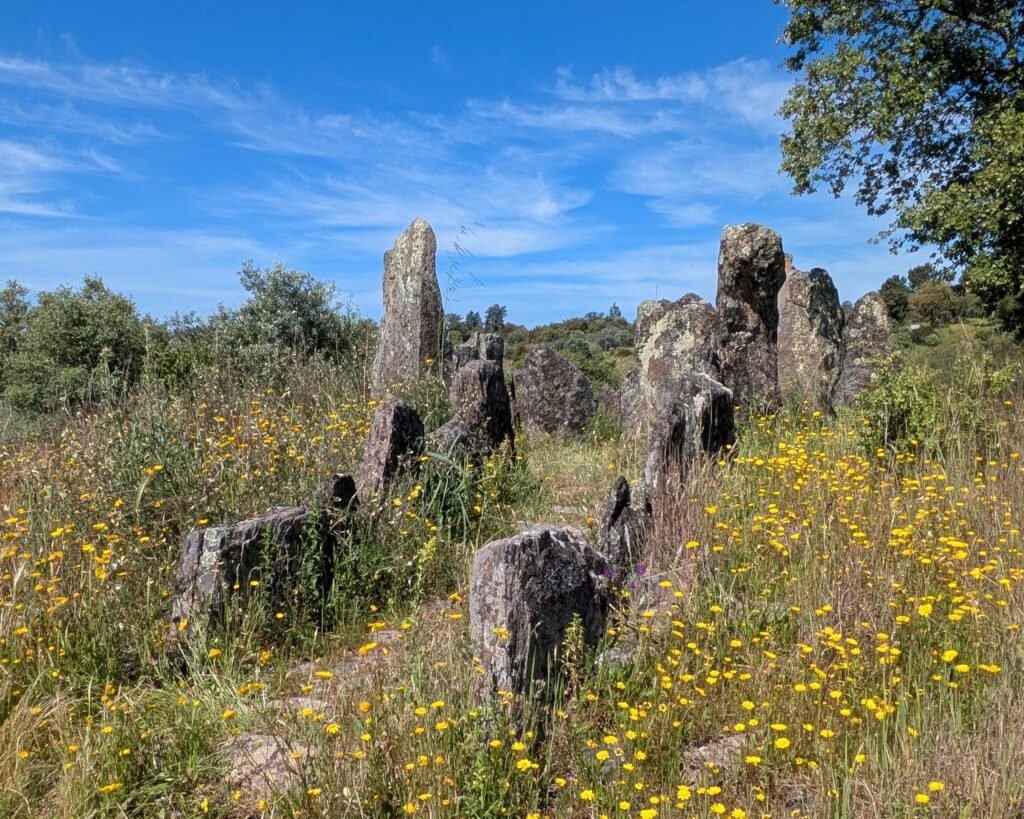
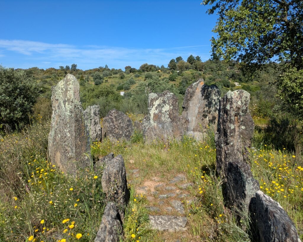

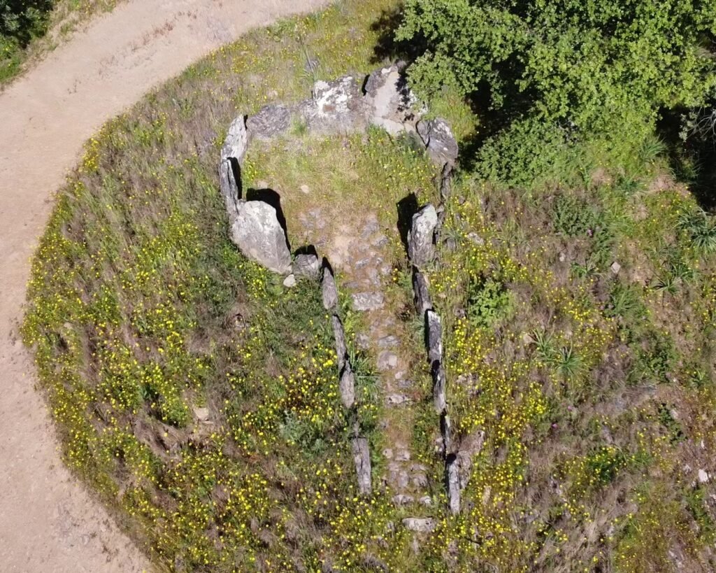
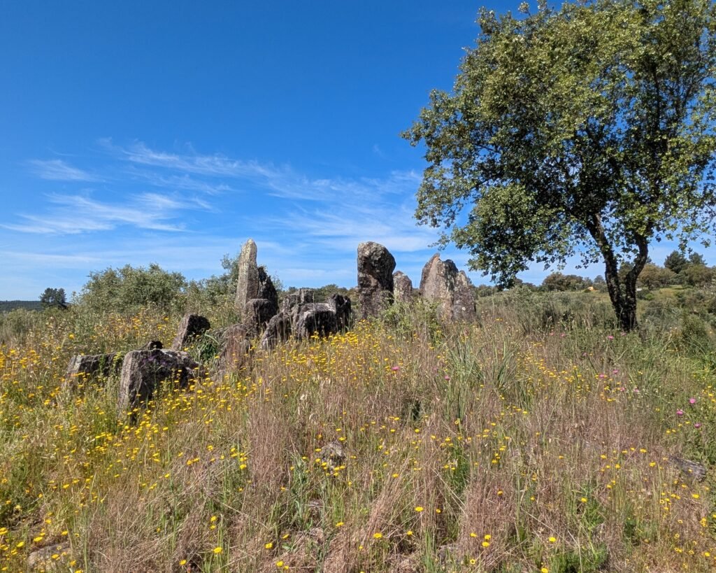
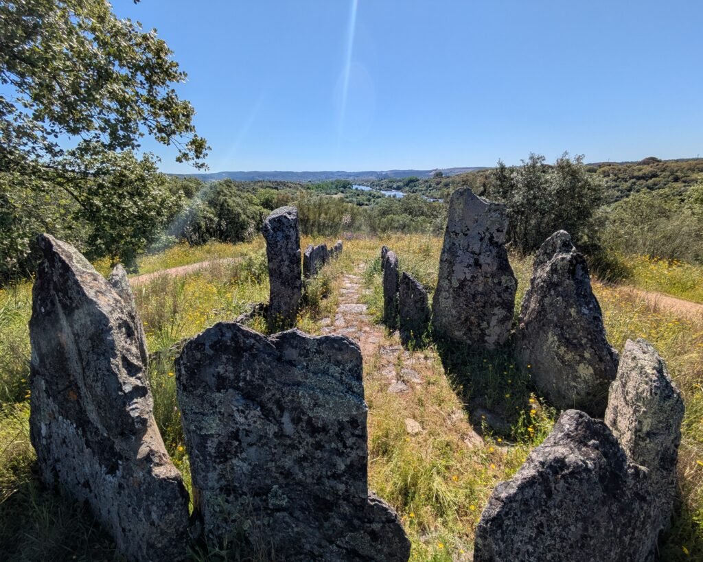
This anta (“dolmen” or megalithic tomb) was built in the Middle/Late Neolithic, about 4,000BC, and used for hundreds of years. It was used again during the Late Chalcolithic, around 2,000BC. It has a commanding spot on a hilltop, looking out over the Rio Tejo (“River Tagus”). Its polygonal chamber is 2.9m in diameter, with eleven pillars (mostly broken by now but reaching up to 3m in height) and a flagstone granite floor. The corridor, 3.3m long and 1.1m wide, is defined by five pillars on either side and faces East, towards the river. The mound is of a cairn type, surrounded by a stone ring which was completed with clay from the banks of the Rio Frio.
Unlike many other monuments in the region, this anta stands alone on its hilltop. Its longevity indicates that it was obviously of some cultural significance, and a range of artefacts from stone tools to a copper dagger were found, mostly in the corridor and surrounding mound. Most of the artefacts are housed in the museum in Mação.)
The anta was identified in the 1970s by Maria Amália and Thomas Bubner, and was excavated by them in the 1980s.
Location
The anta is in the Santarém district, municipality of Mação, parish of Ortiga. It’s located on a hill overlooking the River Tejo (near where the Ribeira do Rio Frio enters). It is just off the Estrada da Estação which runs between Ortiga and Mouriscas.
Coordinates: 39,4741993, -8,0633732
Access
After leaving the tarmac road, it’s a short drive or walk along a fairly level dirt track to the anta. There is a flat path all around the anta.
Signage
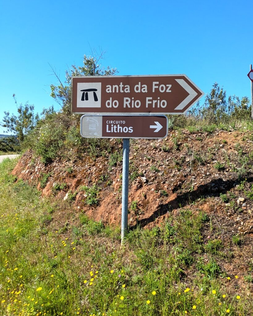
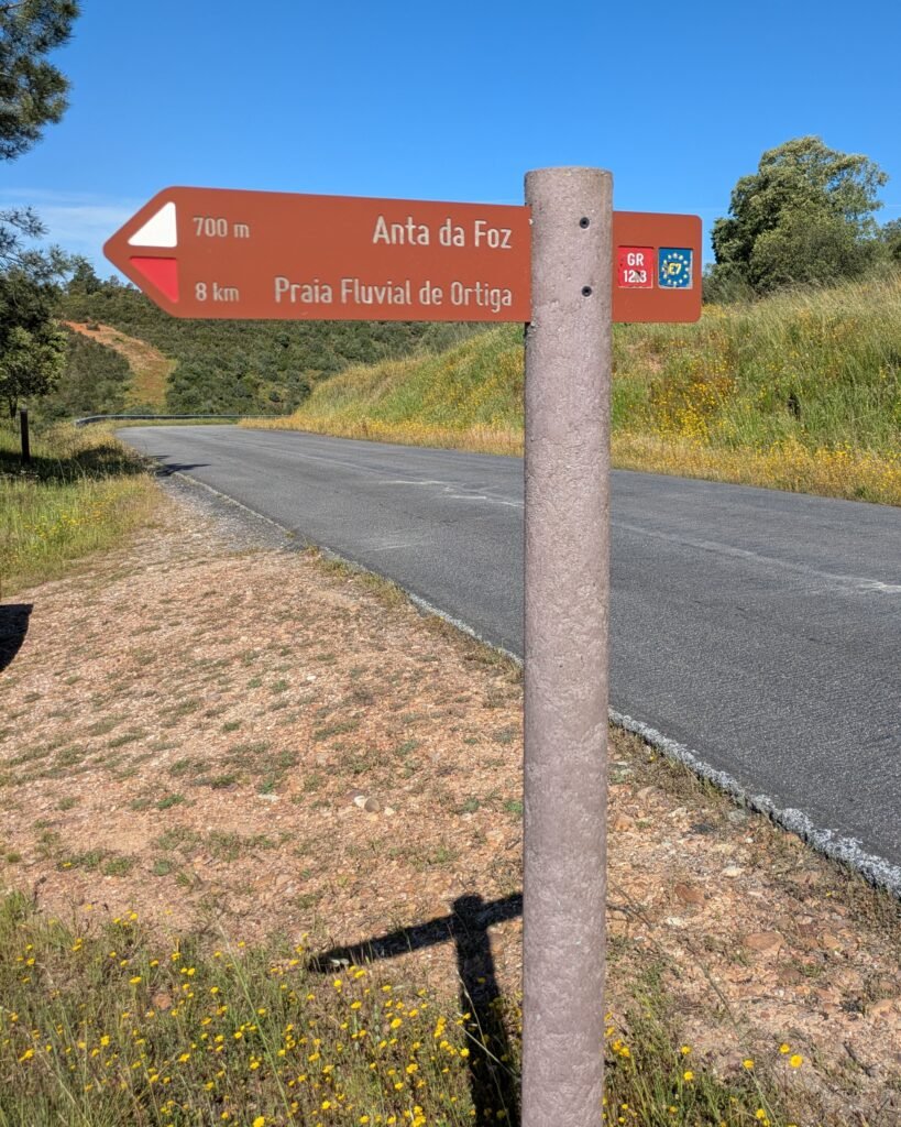
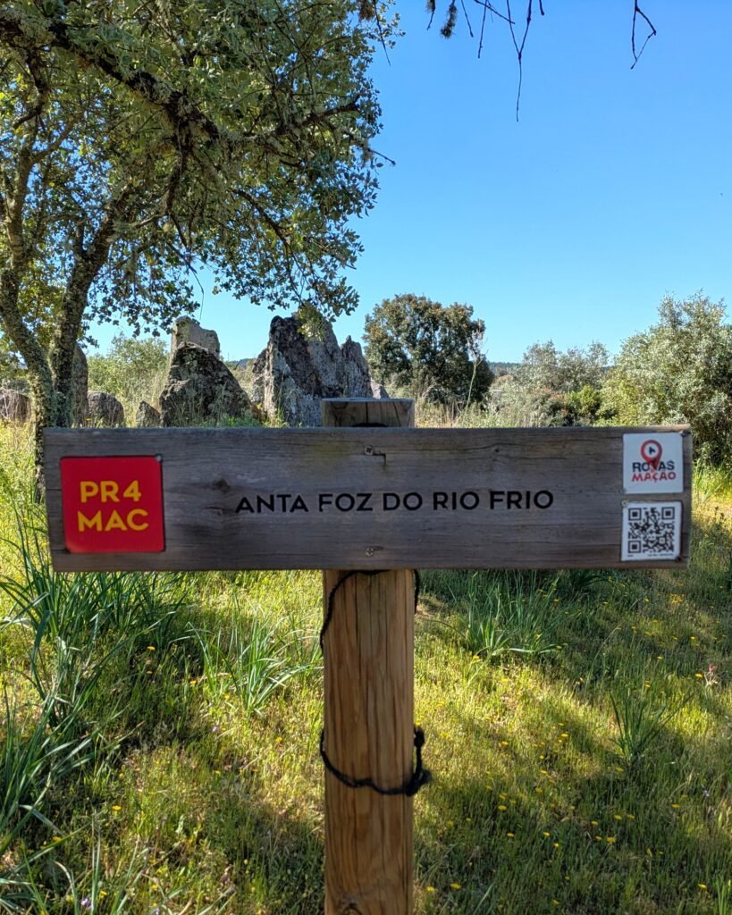
There are signs along the roads in the area directing you to the anta, and identifying it as being on the Lithos Circuit of the museum in Mação. There are information signs (in English and Portuguese) at the anta.
It’s on the PR4 short hiking trail, as well as the GR12.3 long trail. These trail signs point you to the anta.

Links
- Article (in English) from Wikipedia
- Entry (in English) in the Megalithic Portal
- Description (in English) from Rotas Mação
- PR4 hiking trail (in Portuguese) from Rotas Mação
- PDF (in Portuguese and English) of GR12.3 hiking trail from Médio Tejo
- Visitors information (including the Lithos Circuit) (in Portuguese) from the town hall of Mação
- Description (in Portuguese) from Archaeologist’s Portal of Directorate-General of Cultural Heritage
- Designation (in Portuguese) as a Property of Municipal Interest by the Directorate-General of Cultural Heritage
- Detailed information (in Portuguese) in the database of the Directorate-General of Cultural Heritage
Nearby
There is a living prehistoric site only about 3.5km away: an olive tree, the Oliveira do Mouchão, has been dated at 3,350 years old! The Anta do Penedo Gordo is about 9km away. The museum in Mação is about 14km away.
Pingback:Oliveira do Mouchão - Prehistoric Portugal
Pingback:Anta do Vale da Laje - Prehistoric Portugal