
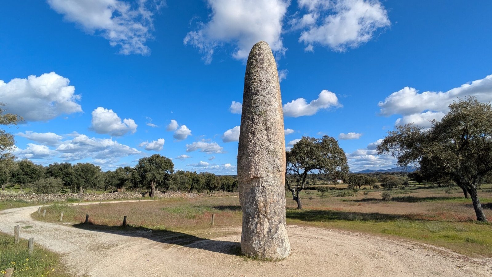
Under the bright blue Alentejo sky, the stone pillar points straight up to heaven. Walk around it, feel the solid stone under your fingertips. Realize that multiple millennia ago, people carved this stone into a spear-shaped phallus and planted it upright into the soil. A human erection thrusting to the heavens, it persists and impresses with its enormous magnitude.

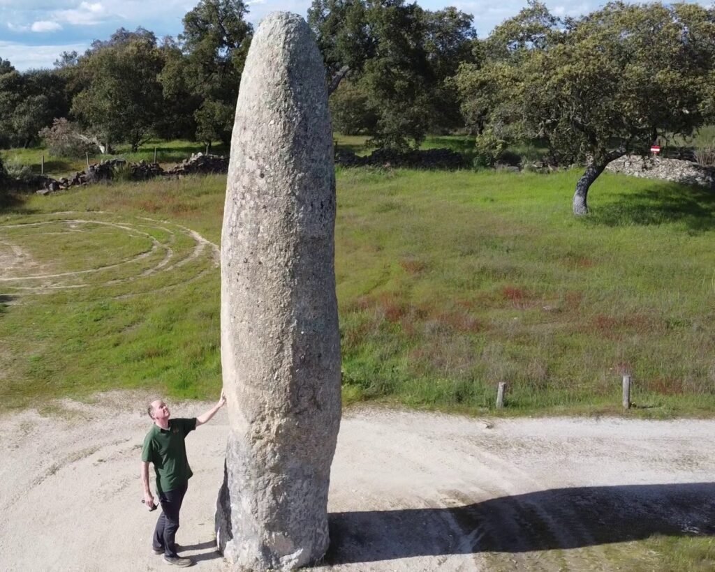


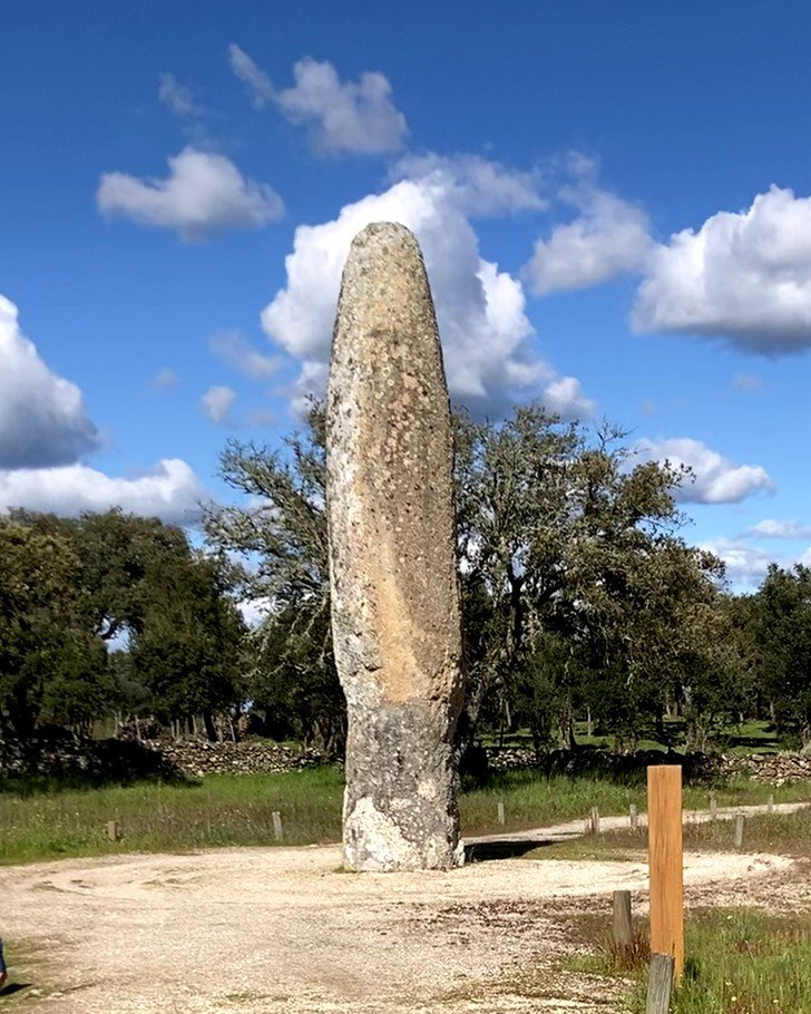

This is the largest menhir in the Iberian Peninsula. Standing over 7m tall (it was likely taller originally: when it was re-erected the surfaces had to be cut to have them match), it is an enormous phallus-shaped stone pointing to the sky. (The descriptions indicate a “glans” shape at the top – I couldn’t see that when I visited.) This granite stone weighs about 15 tons, and is nearly 4m around at the base.
In 1965 it was “discovered” in a cork plantation. It was excavated and re-erected in 1993 by a team of archaeologists led by Jorge de Oliveira1. See his photos below:
- At earliest recording in 1965
- In early analysis in 1992
- The menir broken in 1993
- With people for scale before re-erection in 1993
- In the process of re-erection in 1993
- Being lifted by heavy machinery
It was declared a National Monument in 2013. It is officially dated to the Neolithic or early Chalcolithic period (about the same time as nearby dolmens or antas) Based on radiocarbon dating of coals found beneath its base, it was probably erected around 5000BC, making it over 7 thousand years old. This is probably the oldest menir in the world.
Location
The menir is in the Alto Alentejo region, district of Portalegre, municipality of Castelo de Vide, parish of Santa Maria de Devesa. It’s near the village of Póvoas e Meada, and about 12km north of the town of Castelo de Vide.
Coordinates: 39,4960159, -7,4457254
Access
There are roads (dirt) leading to the menir, and easy parking nearby. The area around the menir is flat, and there are picnic tables and easy walking around it.
Signage
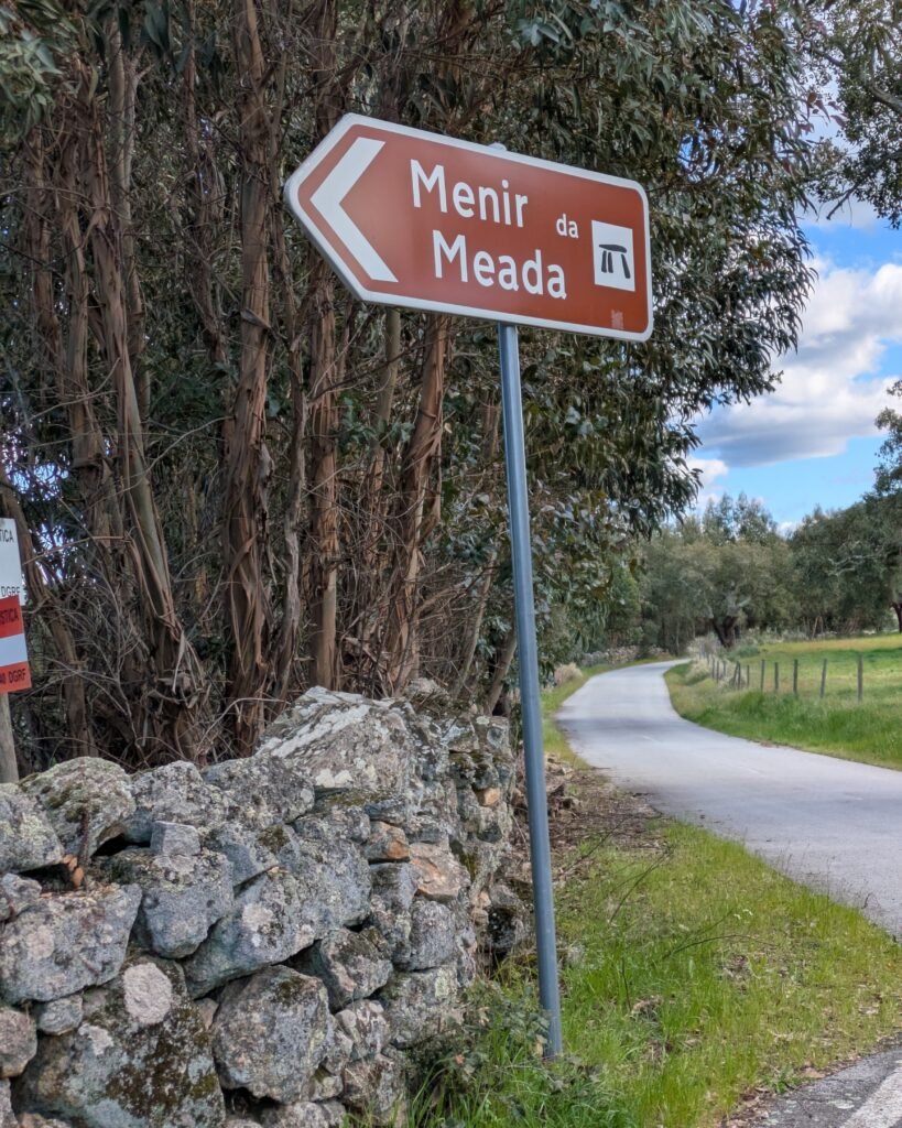
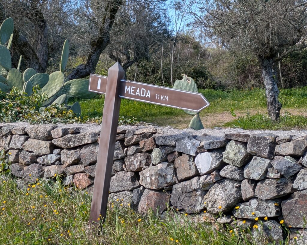
There are signs on roads in the area pointing towards the menir. The “official” metal signs have a dolmen icon (indicating an archaelogical site), while other, smaller, wooden signs have a menir icon.
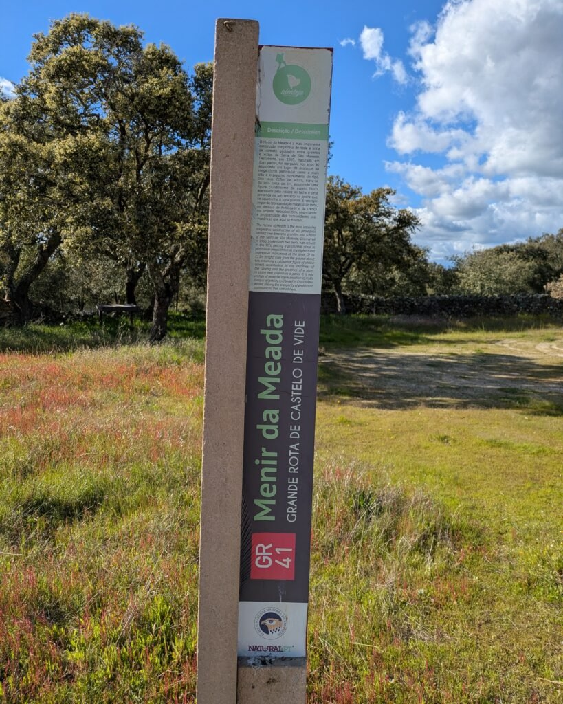
At the site, there is a table panel with information (in Portuguese) about it and the other prehistoric sites in the area, and another vertical “pillar-style” post with some information about the Menir da Meada in both Portuguese and English.

Links
- Article (in English) from Wikipedia
- Entry (in English) in the Megalithic Portal
- Article (in Portuguese) from National Geographic
- Description (in English) of the GR41 “Grande Rota de Castelo de Vide” trail (including the Menir da Meada) from Natural.pt
- Page (in Portuguese) with information and a PDF map about the GR41 trail from the Castelo de Vide town council’s tourist site
- Description (in Portuguese) from the parish council of Nossa Senhora da Póvoa e Meadas,
- Description (in Portuguese) from Archaeologist’s Portal of Directorate-General of Cultural Heritage
- Designation (in Portuguese) as a National Monument by the Directorate-General of Cultural Heritage
- Detailed information (in Portuguese) from the database of the Directorate-General of Cultural Heritage
Nearby
There are many prehistoric sites around Castelo de Vide. Some of the closest (and easily!) visitable sites are the Anta do Pincho and Anta dos Pombais – both about 8km to the south, towards Castelo de Vide.
Sources
- de Oliveira, Jorge. O Menhir Da Meada. Lisboa, Edições Colibri, 12 Oct. 2023. ↩︎
Pingback:Parque Megalítico dos Coureleiros - Prehistoric Portugal
Pingback:What Motivates People to Move Megaliths? - IEyeNews
Pingback:Menhir da Meada: el monolito neolítico más alto de Europa