

Also known as: Anta da Nave do Grou
As the wind blows across the meadow, it carries the sound of hissing traffic on the nearby road as well as the tinkling of bells of the cows in the pasture. The grass on the mound wavers in the wind all around the stones. The ancient structure stands proudly on a small mound, oblivous to the cow pats and blowing leaves. The structure seems short and stocky, as if to show off its hearty longevity.

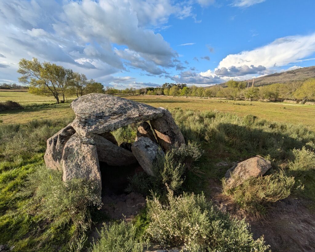


This anta (or dolmen) has a polygonal chamber with 7 orthostats. The orthostats are quite thick, often as thick as they are wide, and placed close together. The chamber is about 2.5m by 1.5m. No trace of a corridor was found, but traces found of the tumulus indicate it was about 25m across. The construction indicates that this anta was built in the Late Neolithic, between 3750 and 3125 BC, although artefacts found indicate it was still in use during the Chalcolithic period.
Antas have been known in the area since at least the 1400s, but not specifically identified. The Anta do Sobral was first recorded in 1868 by Francisco Pereira da Costa as “dolmen at the bottom of Nave do Grou on the Sobral site.” It was declared a National Monument in 1910 (listing both names). It was not properly excavated until the 1980s. The capstone was replaced in 1992 under the direction of archaeologist Jorge de Oliveira during restoration work. (See his photograph here.)
Location
The anta is in the region of the Alto Alentejo (“Upper Alentejo”), district of Portalegre. It’s in the municipality of Castelo de Vide, parish of São João Baptista. It’s very close (about 5.5 km) to the town of Castelo de Vide, along the EN246 heading south towards Portalegre.
Access
The anta is on private property. Be respectful.
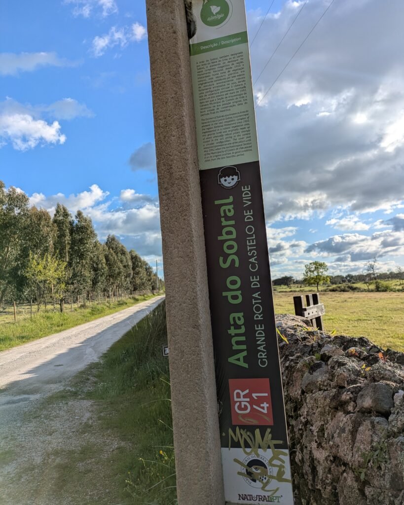
The anta is located on a private field in a farm, the Herdade do Sobral. It’s accessible through a closed gate: just make sure that you close the gate behind you. The anta is in a field that is actively used as a cow pasture. (Mind the cows and mind your step!) It is included on the GR41 long-distance trail, the “Grand Rota de Castelo de Vide.”
Signage
There is a small brown sign on the turnoff from the EN246, and then another (damaged) sign at the gate. There is an information post outside the gate in both Portuguese and English.


Links
- Entry (in English) from the Megalithic Portal
- Description of the GR41 hiking trail (in English) published by Natura.pt
- Webpage with PDF brochure of the GR41 hiking trail (in Portuguese) by the Municipality of Castelo de Vide
- Description (in Portuguese) from Archaeologist’s Portal of Directorate-General of Cultural Heritage
- Designation (in Portuguese) as a National Monument by the Directorate-General of Cultural Heritage
- Detailed entry (in Portuguese) from the database of the Directorate-General of Cultural Heritage
Nearby
The municipality of Castelo de Vide has dozens of prehistoric sites. The nearest is the Anta da Melriça: about 6km away along the N246 heading North towards Nisa.
Pingback:Anta de Melriça - Prehistoric Portugal
Pingback:Anta da Melriça - Prehistoric Portugal