
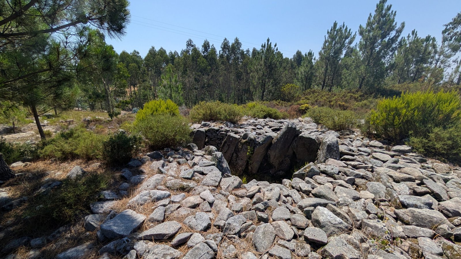
Walking along the forest trails, the peace and quiet is almost palpable. There are stone outcrops all around, as well as large stones in the trail itself. So it’s not surprising to see a large hill of stones beside the trail …until you look closer and see that these stones were put there to create a mound covering a funerary chamber
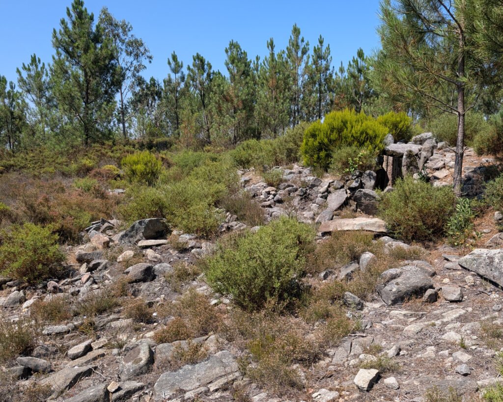
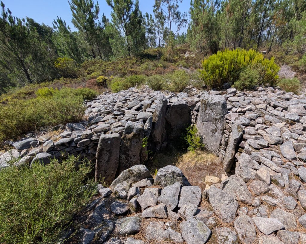
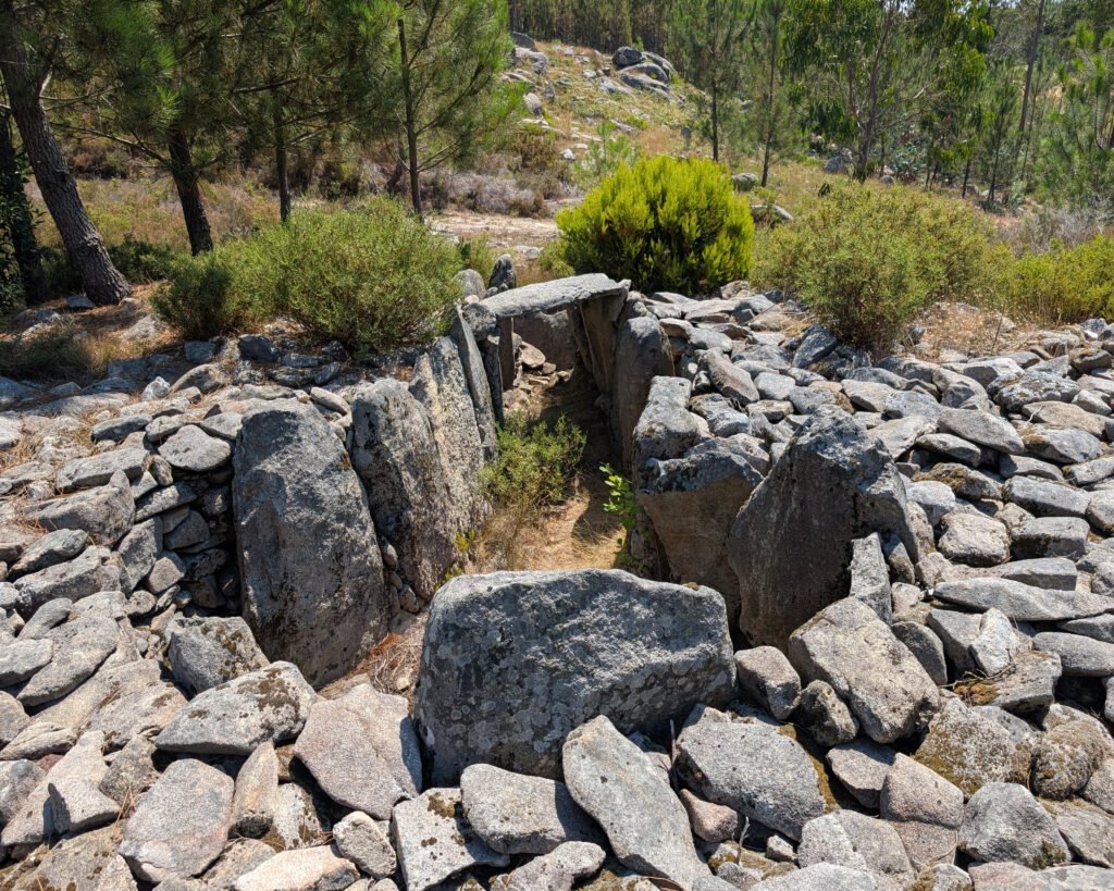
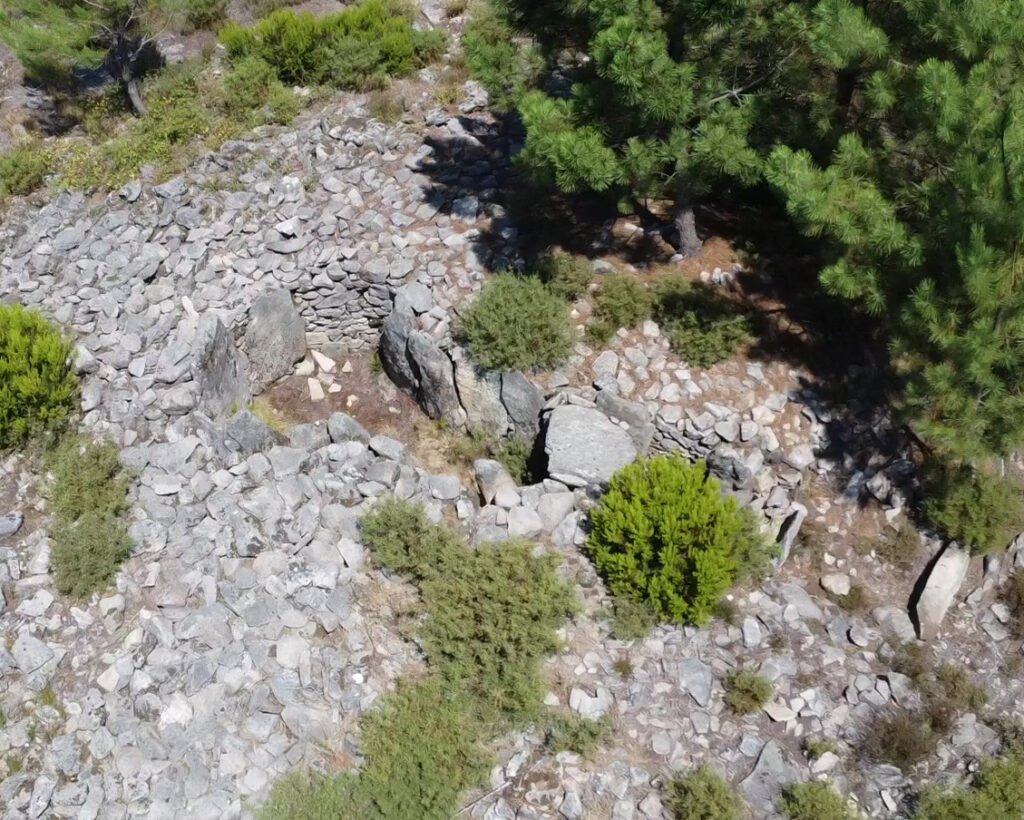
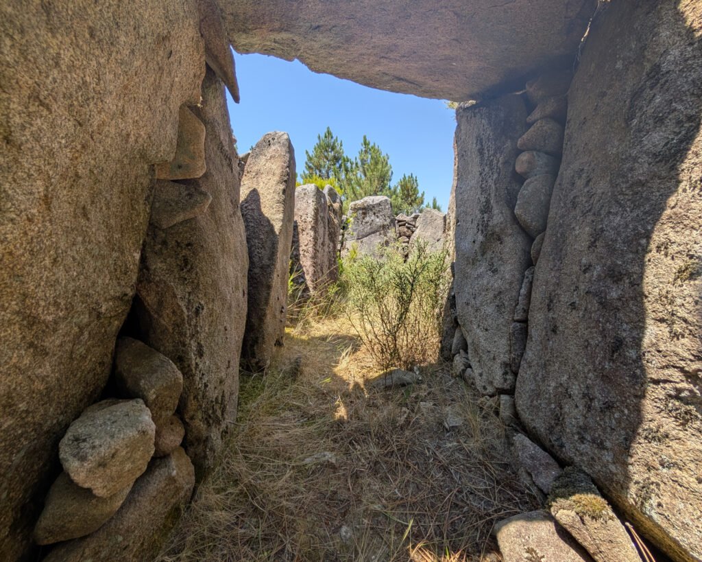
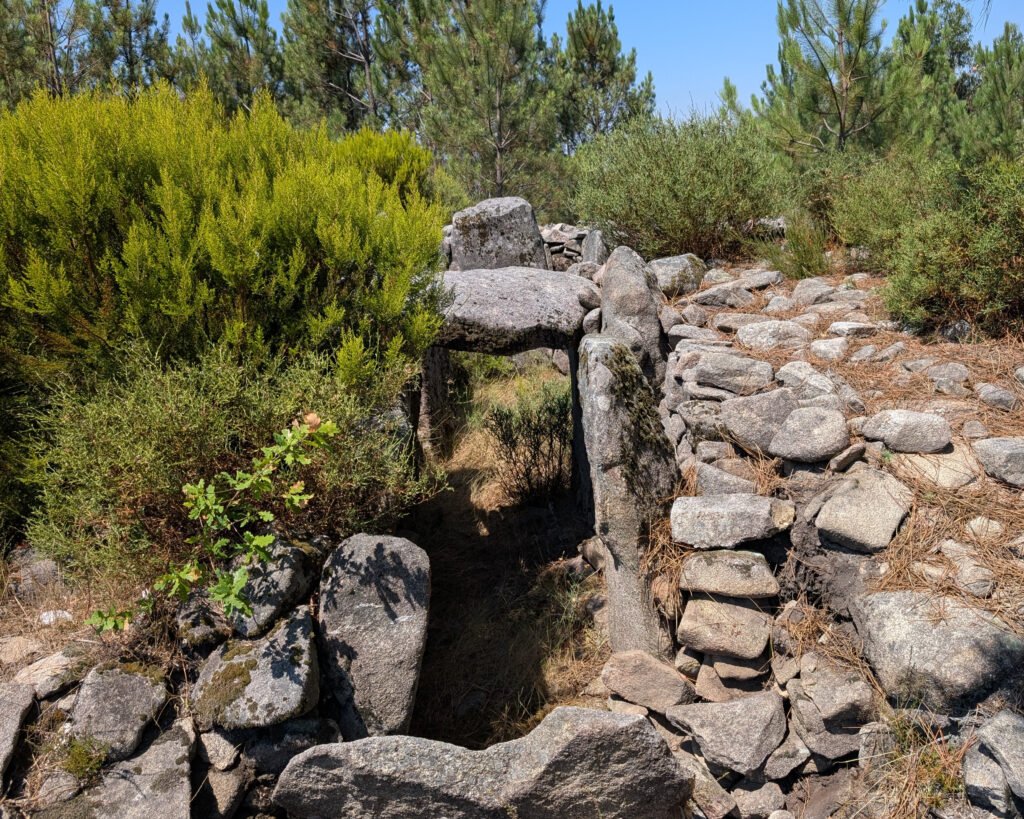
This anta (this is the usual Portuguese word for a dolmen, or prehistoric megalithic tomb) is an unusual one, having a stone cairn surrounding it. It can be dated possibly to the beginning of the 4th millennium BC: around 6,000 years ago1.
It was identified in 1981 by Ana Bettencourt. It has a polygonal chamber with 12 remaining orthostats (upright stones), and a corridor (13 standing orthostats) pointing to the east. There is one capstone over the corridor, as well as a closing stone at the end of the corridor.
The anta is enclosed in a stone mamoa (tumulus, or enclosing mound) or cairn. The mound is around 14m North-South, and over 16m East-West. There is a section of the surrounding retaining wall which is still visible.
During the 2008 excavation, it was determined that the tumulus was a proper cairn, made up of medium to large granite stones tightly intertwined. The excavation trenches confirmed this structure2.
Location
The anta is located in Central Portugal, in the district of Aveiro. It’s in the municipality of Sever do Vouga, in the freguesia of Talhadas. It’s in the mountains near the village of Silveira, just below the peak of Santa Maria da Serra.
Coordinates: 40.671314, -8.315531
Access
The anta is alongside a forest trail. It’s not very difficult to reach, but requires a few hundred meters of hiking along sloping and uneven trails.
Signage
There are no signs directing you to the anta. You can follow road signs to the Santa Maria da Serra lookout (there is a church and picnic spot with parking there).
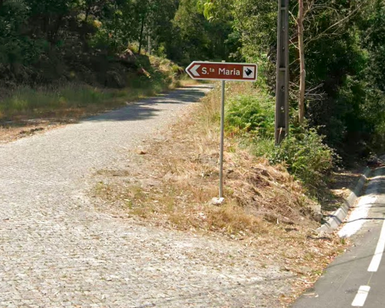
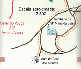
From the peak of the Sanctuary of Santa Maria da Serra, head downhill towards the southwest. The anta is about 600m away, along reasonably good trails although they’re not well marked.
The anta is located along the PR5 trail, “Rota do Megalítico,” along with two other prehistoric sites. You can find details (and a PDF of the map) on Trilhos e Caminhadas or the original of the map (and another PDF with more information) from the Municipio de Sever do Vouga.
Links
- Entry (in English) in the Megalithic Portal
- Detailed information (in Portuguese) from the Digital Encyclopedia of Sever do Vouga
- Video (captions in Portuguese and English) from the Museum of Sever do Vouga
- Description (in Portuguese) from Montanhas Mágicas
- Description (in Portuguese) of the PR5 trail from Trilhos e Caminhadas with a downloadable PDF
- PDF map and information (in Portuguese) about the PR5 trail from the Municipality of Sever do Vouga
- Description (in Portuguese) from Roteiro dos Museus e Centros Museulógicos do Região Centro
- Description (in Portuguese) from Archaeologist’s Portal of Directorate-General of Cultural Heritage
Nearby
The Anta da Capela dos Mouros and the Anta do Sepultura do Rei are both on the same PR5 trail. The “Megalithic Necropole” of Chão Redondo (with a beautiful engraved dolmen) is nearby just outside of Telhadas. There are LOADS of prehistoric sites in the region!
Sources
Sobral de Carvalho, Pedro. Pré-História. Os Senhores Das Montanhas, in Genius Loci: O Espírito Do Lugar, Ed. Câmara Municipal De Sever Do Vouga, Coord. Eon, Indústrias Criativas, Lda, 2013: 42-65. https://www.academia.edu/31722737/Pr%C3%A9_hist%C3%B3ria_Os_senhores_das_montanhas_in_Genius_Loci_O_Esp%C3%ADrito_do_Lugar_ed_C%C3%A2mara_Municipal_de_Sever_do_Vouga_coord_Eon_Ind%C3%BAstrias_Criativas_lda_2013_42_65 Accessed 12 July 2026.
Pêgo, Maria Carlos Chieira. Roteiro do Megalitismo. Câmara Municipal de Sever do Vouga. Santa Maria da Feira, 2002. https://app.box.com/s/4xhf8nmzwopaja3mxyy5eparcc23ln77 Accessed 13 July 2026.
Cited references:
- “Poço Dos Mouros (Dólmen).” A Enciclopédia Digital de Sever Do Vouga, Museu Municipal de Sever do Vouga, 11 May 2020, https://www.mm-sever.pt/wikisever/doku.php?id=poco_mouros_dolmen. Accessed 12 July 2026. ↩︎
- Marques, Maria de Fátima Tavares e Miguel Filipe Pereira Marques, “Relocalização/Identificação (2005)” https://arqueologia.patrimoniocultural.pt/index.php?sid=trabalhos&subsid=2424335 Accessed 12 July 2026 ↩︎