

Also known as: Anta das Tapadas do Pincho
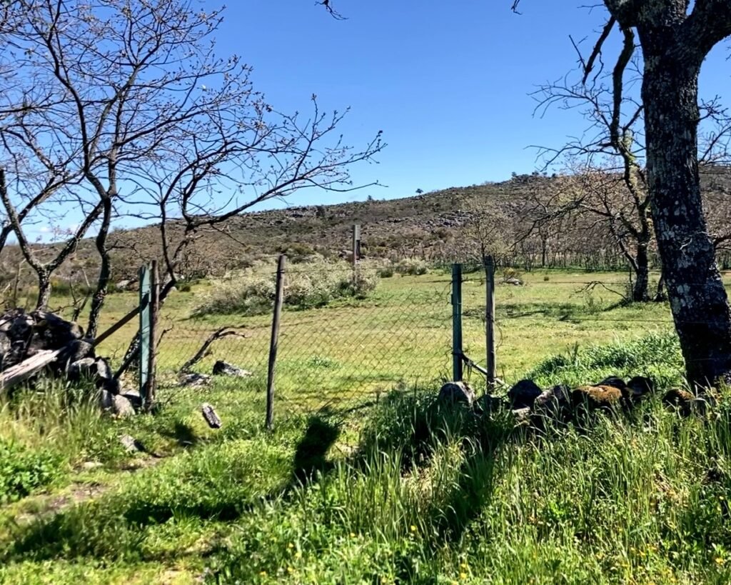
Standing in a pasture in the middle of the Alto Alentejo, the silence all around you is almost palpable. The railway line nearby has long since been abandoned. The dirt track gets little, if any, traffic. The cows are elsewhere. There’s nothing to hear but insect whine, birdsong …and the wind gently blowing through the trees. Look down and look closely at the bushy copse. Granite stones stick out a few centimeters above the bushes. Broken and tumbled, it’s hard to make out that they had been intentionally positioned. But thousands of years ago these stones were used to build a megalithic structure. They haven’t aged well, but four thousand years later it’s impressive that they have survived at all.

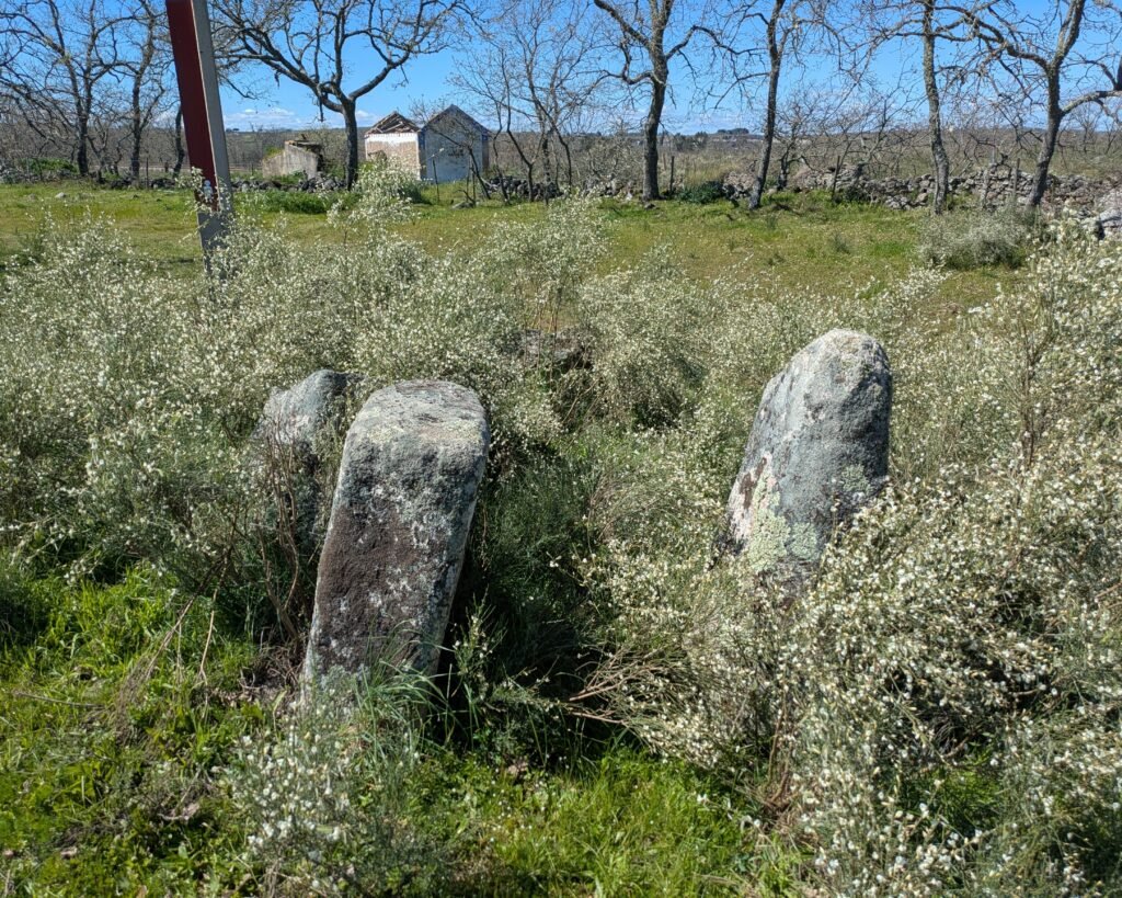

This anta (“dolmen”) is in quite a state of ruin. There would have originally been seven granite orthostats (upright stones) forming an elongated polygonal chamber. Only five remain and all the stones are fractured. There are two stones that seem to indicate a corridor pointing to the east.
The anta was first identified in 1985. There does not seem to be any real research or much documentation of this anta. It is apparently in the process of being categorized as a property of interest. It likely dates back to the Neo-Chalcolithic period, during the second millennium BC.
The information sign near the anta (posted by Natural.PT & the Park of Serra de São Mamede), says only:
“The Dolmen of Pincho shows, like all the others in the region, the ancestral presence of Man in this fertile territories since the times prior to history. Megalithic tomb of rough granitic features, was initially composed of seven pillars buried in the ground, of which only five remain standing today, although broken by the course of millennia. The resisting structure presents an elongated polygonal configuration, with entrance oriented to the east.
When I visited, it was very overgrown and the stones were difficult to see. The visit was made more worthwhile for the walk through the countryside.
Location
The anta is in the Alto Alentejo area (“Upper Alentejo”), in the district of Portalegre. It’s in the municipality of Castelo de Vide, parish of Santa Maria da Devesa. It’s about 5km north of the town of Castelo de Vide.
GPS coordinates: 39,4396663, -7,4519783
Access
The anta is location on private land. Please be respectful.
You can reach the anta along the PR2 trail, “Recorrido de Torrinha.” There is a dirt road that leads off from the municipal road, EM1006, near the railroad crossing. The anta is about 450m along that road, near an abandoned railroad building. There is a gate which can be opened, and the anta is just beyond.
Signage
There are signs along the trail pointing out the Anta do Pincho. Next to the anta, there is an information sign with some general information in both English and Portuguese.


Links
- Entry (in English) in the Megalithic Portal
- Description (in English) of the PR2 hiking trail from Natural.pt
- Description with downloadable PDF (in Portuguese) of the PR2 hiking trail from town hall of Castelo de Vide
- Description (in Portuguese) from Archaeologist’s Portal of Directorate-General of Cultural Heritage
Nearby
There are many prehistoric sites around Castelo de Vide. The closest (only a few hundred meters) is the Anta dos Pombais, also along the PR2 “Recorrido de Torrinha” trail.
Pingback:Menir da Meada - Prehistoric Portugal
Pingback:Anta dos Pombais - Prehistoric Portugal
Pingback:Parque Megalítico dos Coureleiros - Prehistoric Portugal