

Also known as: Dólmen da Pedra Branca, Monument Megalitico da Pedra Branca
Walk around the boardwalk and look down at the stones. Their regular placement shows human work. Think about the four and a half thousand years that separate you from their original builders. Did the builders choose this hilly spot for the views to the ocean, 5km away? Was their decision to use some white limestone along with the brownish sandstone a result of practicality, or aesthetics?
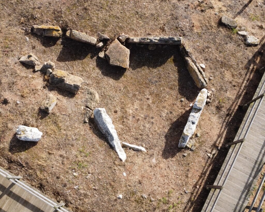
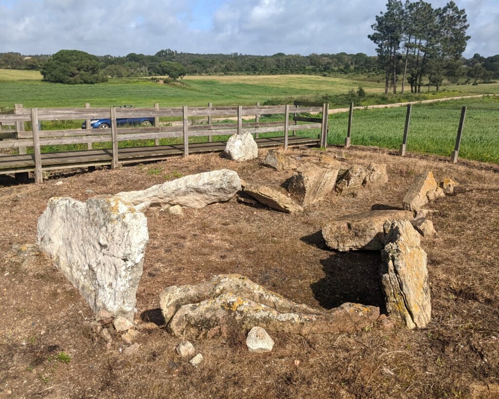
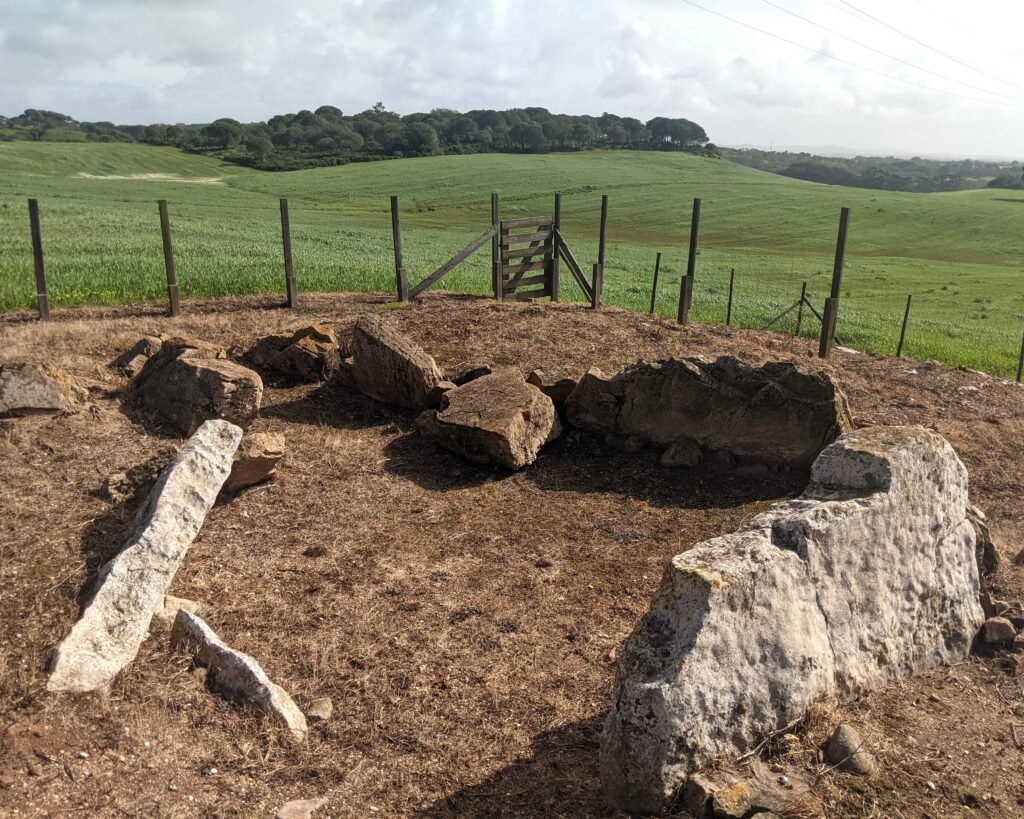
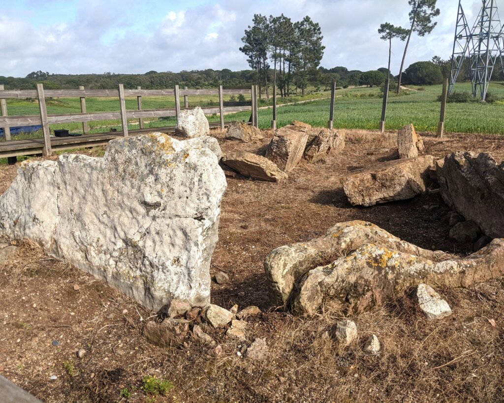
This dolmen is a chambered structure, with a large polygonal chamber (approximately 3.8m by 3.4m) formed by eight pillars of sandstone and limestone. There was a central quartzite pillar that held up the roof. No trace of the roof has been found, but the use of a central pillar is consistent with false-dome “tholos” constructions. There is a corridor, facing East, that is about 3.5m long and 1.5m wide at its widest. The dolmen is on a slight hill, partially formed by its original tumulus (or “mamoa”).
It was likely constructed during the Late Neolithic period, about 2,500BC. It was reused during the Chalcolithic, about 2,000BC. Many artefacts were found from both periods of use. In particular, in the earliest phase about 65 remains were found including slate plaque necklaces as well as stone tools and more.
It was discovered by L. Trindade and A. Rodrigues (of the Portuguese Geological Survey) and excavated in 1972 and 1975 by Octávio da Veiga Ferreira. Further work was done in 2012 by Maria Joaquina Coelho Soares.
Location
The dolmen is in the district of Setúbal, municipality of Grândola, parish of Melides. It’s on rural roads outside the village of Vale Figueira. The nearest town is Melides.
Coordinates: 38.113192, -8.724020
Access
The site is easily reached by car or on foot. There is a boardwalk around the dolmen and information signs in both English and Portuguese.
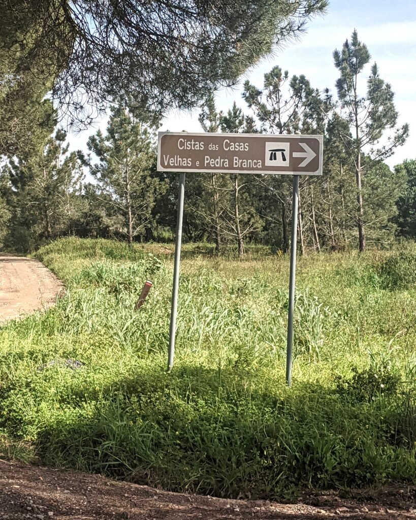
Signage
There are signposts on the N261 outside the town of Melides, about halfway between Comporta and Sines. (From Grândola, head towards Melides on the N261-2, and the signs are on the other side of Melides.) Once off the main road, you head towards Vale Figueira. There are more signs in Vale Figueira, but it’s easy to get lost. You can use the GPS coordinates (38.113192, -8.724020) to get you to the site.
Links
- Article (in English) from Wikipedia
- Entry (in English) in the Megalithic Portal
- 3D Model (no language) by Luís Câmara on Sketchfab
- Detailed information about the site and its artefacts (in Portuguese) from CIMAL (Comunidade Intermunicipal do Alentejo Litoral)
- Description (in Portuguese) from the municipality of Grândola
- Description (in Portuguese) from the Visit Grândola website
- Description (in Portuguese) from Archaeologist’s Portal of Directorate-General of Cultural Heritage
- Designation (in Portuguese) as a Property of Public Interest by the Directorate-General of Cultural Heritage
- Detailed information (in Portuguese) from the database of the Directorate-General of Cultural Heritage
Nearby
The Necrópole (or “Cistas”) das Casas Velhas is only about 650m away. There are other sites in the municipality: the Monumento Megalítico da Pata do Cavalo and Monumento Megalítico do Lousal, both antas (dolmens), are not far away.